- Introduction
- Report Readers
-
Report Authors
- Standalone Designer
- WebDesigner
- Report Types
-
Report Controls
- Report Controls in Page/RDLX Report
- Report Controls in Section Report
- Report Wizard
- Data Binding
- Design Reports
- DevOps
- Developers
- Samples
- Troubleshooting
Set the Color Scale on a Map
A color scale helps a user to understand the range of colors that are used for data visualization on a layer. A map has just one color scale and multiple layers can provide data for it. Use these steps to learn setting a color scale on a map.
- On the design surface, select the Map control.
- In the Properties window, click the ColorScale property and then click the ellipsis (...) button that appears.
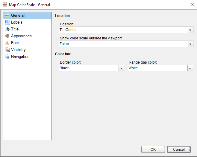
- In the Map Color Scale dialog that appears, on the General page, you can set the location and the color of the color scale.

- On the Labels page of the dialog, you can make modifications to the properties of the color scale labels.
- On the Title page of the dialog, you can make modifications to title text and font properties of the color scale.
- On to the Appearance page, you can make modifications to the border width, style, color and background color.
- On the Font page, you can make modifications to the font properties of the color scale.
- On the Visibility page, you can setup the visibility mode of the color scale.
- On the Navigation page, you can setup the interactivity features for the color scale.
- Click OK to close the dialog.


