# Tooltip
Display tooltip for different data points or elements on the map using the MVC FlexMap control. Learn more about the MVC FlexMap in ASP.NET MVC documentation.
## Content
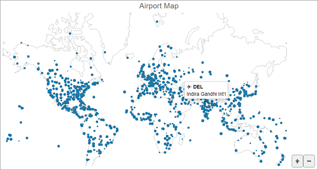
Tooltip appears when you hover the mouse on a data point or an element. FlexMap allows you to display the tooltip using the **Tooltip** property and the information about the data points or elements in the tooltip using the **Content** property.
The following image displays an airport name in the tooltip appearing on mouse hover over a data point on map.
****
The following code demonstrates how to customize tooltip:
```razor
@using System.Drawing
@{
string[] palette = new string[]
{
"#fbb258", "#90cd97", "#f6aac9", "#bfa554", "#bc99c7",
"#eddd46", "#f07e6e", "#88bde6", "#8c8c8c" };
}
@(Html.C1().FlexMap().Id("flexMap")
.Header("Airport Map")
.Height(500)
.Tooltip(tt => tt.Content("✈ {iata_code}
{name}"))
.Layers(ls =>
{
ls.AddGeoMapLayer()
.Url("/Content/data/land.json");
ls.AddScatterMapLayer()
.Url("/Content/data/airports.json")
.Style(s => s.Fill("rgba(0,119,179,1)"))
.Binding("x,y,flow")
.SymbolMinSize(2)
.SymbolMaxSize(8)
.OnClientItemsSourceChanged("scatterMapItemsSourceChanged");
})
)
```