# Set the Distance Scale on a Map
This topic provides steps on how to set a distance scale on a map control.
## Content
A distance scale helps a user to understand the scale of the map. Distance on a map is not the same as the actual real-world distance, so a distance scale shows that a certain distance on the map equals a certain distance in a real-world. In distance scale, the distance is displayed in both miles and kilometers. The scale range and values are automatically calculated using the viewport boundaries, projection type, and zoom level. Use these steps to learn setting a distance scale on a map:
1. On the design surface, select the [Map](/activereportsnet/docs/v19.2/report-authors/report-controls/report-controls-page-rdl-report/map) control.
2. In the Properties window, click the **DistanceScale** property and then click the ellipsis (...) button that appears.
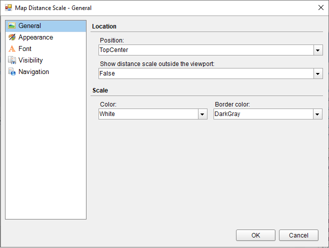
3. In the **Map Distance Scale** dialog that appears, on the **General** page, you can set the location and the color of the distance scale.
4. On the **Appearance** page of the dialog, you can make modifications to the border width, style, color and background color.
5. On the **Font** page of the dialog, you can make modifications to the font properties of the distance scale.
6. On the **Visibility** page of the dialog, you can setup the visibility mode of the distance scale.
7. On the **Navigation** page of the dialog, you can setup the interactivity features for the distance scale.
8. Click **OK** to close the dialog.